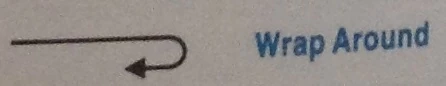
The magical law of "containment" otherwise known as 'Wrap Around/wrap around' is a strange phenomena occurring in the early King's Quest games (1-4). It is not just a game mechanic, but also appears in the artwork and by some in-game directional discription, as well as officially published lore.
Background[]
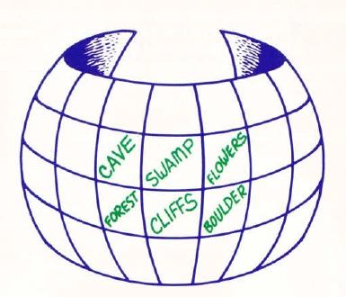
The magical law of "containment" is a strange magical barrier that folds space back upon itself creating a loop (cosmic doughnut) that puts travelers back where they started in the lands. Essentially it turns the land into a self-contained pocket universe that exists both inside and outside of the main World of Daventry (half merged physically with world, miles or leagues from other lands, but also in another world separated across dimensions). The regions contained in the bubble wrap around a small globe-like world inside the barrier.[1][2][3][4][5] The barriers often exist on two or more sides of the land they surround. In those those lands with fewer barriers, the geography of the regions without barriers connects directly back to the greater world of Daventry. Where the warping topography exists between the barriers the land connects smoothly together as if was naturally occurring geography.
One such barrier exists on northern and southern edge of the Land of Kolyma. Thus if an adventurer were to head north through the great strangeness they will always end up back in the south. From the perspective of the traveler the land seems to connect seamlessly. Geography seen in the distance seems blend into the natural geography. Thus when they actually pass through the barrier itself, they do not notice since it seems as if they are traveling to an actual point that they saw in the distance. So if a traveler was to head north they would not notice when they had actually ended up being transported back to the south. These barriers have been seen in Daventry, Kolyma, Llewdor, and even Tamir.
The great strangeness of the continent of Kolyma blocks travel to the northern and southern shores of the continent, while a mountain range and a great chasm blocks access to the eastern lands of the continent.
The containment barrier that was put up around Daventry blocked travel to surrounding kingdoms[6]. Though its suggested that Graham may never encountered the barrier during his journey, had he known about it he would have found it useful[7]). However, if one follows the Nameless court scribe's chronicle of King Graham's journey; one notices Graham was wrapping around the map without even realizing it! Though in time it faded away, at later times it was replaced by other kinds of barriers. During the years the Three-Headed Dragon attacked Daventry, other kingdoms built walls between Daventry to keep the Dragon contained there, so it wouldn't pass into their lands. At the same time, huge rifts in the earth were opened due to earthquakes blocking travel to the south.
The barrier that was put up around Llewdor blocked travel to the northern and southern shores of Tanalore, while the Medusa Desert, Swamp and Impossible Mountains to the west blocked access to Tamir and other kingdoms. The Three Bears' House and Port Bruce lay to the south of Manannan's mountain, but could both be seen by looking north from the mountain. The mountain could be seen to the north of the Three Bear's House.
The barrier in Tamir blocked access to southern and northern shores of Tanalore while the impossible mountains, the Swamp, and the Medusa Desert blocked access to other kingdoms and Llewdor.
Complete sets of maps are invaluable in the lands where the geography "wraps around" upon itself, and where explorers find themselves going from the northernmost edge of a continent to the southernmost in one short step.
Analyzing the maps[]
The idea of world wrapping is not just something that occurs just as a gameplay mechanic or as part of the lore in early King's Quest manuals/King's Quest Companion, but something that appears physically part of the world as seen in the artwork or within screen direction descriptions. This section attempts to analyze landmarks of each game that are physically affected by such wrapping visually and/or descriptively.
The Companion's primary purpose is that of a walkthrough and strategy guide, and thus sticks to the game mechanics when explaining events. This is so that a player can still use the book as a game guide, and follow the most efficient route through the game, with leas backtracking. The book uses the term 'magical law of "containment" to incorporate an in-universe explanation for the phenomena (so the player knows they can take a short cut to reach the next area in the game), or simply has the character wrapping around the lands unknowingly as in KQ1. Either way, if the player chooses to use the novel to complete the game, they will be taking advantage of the wrap around.
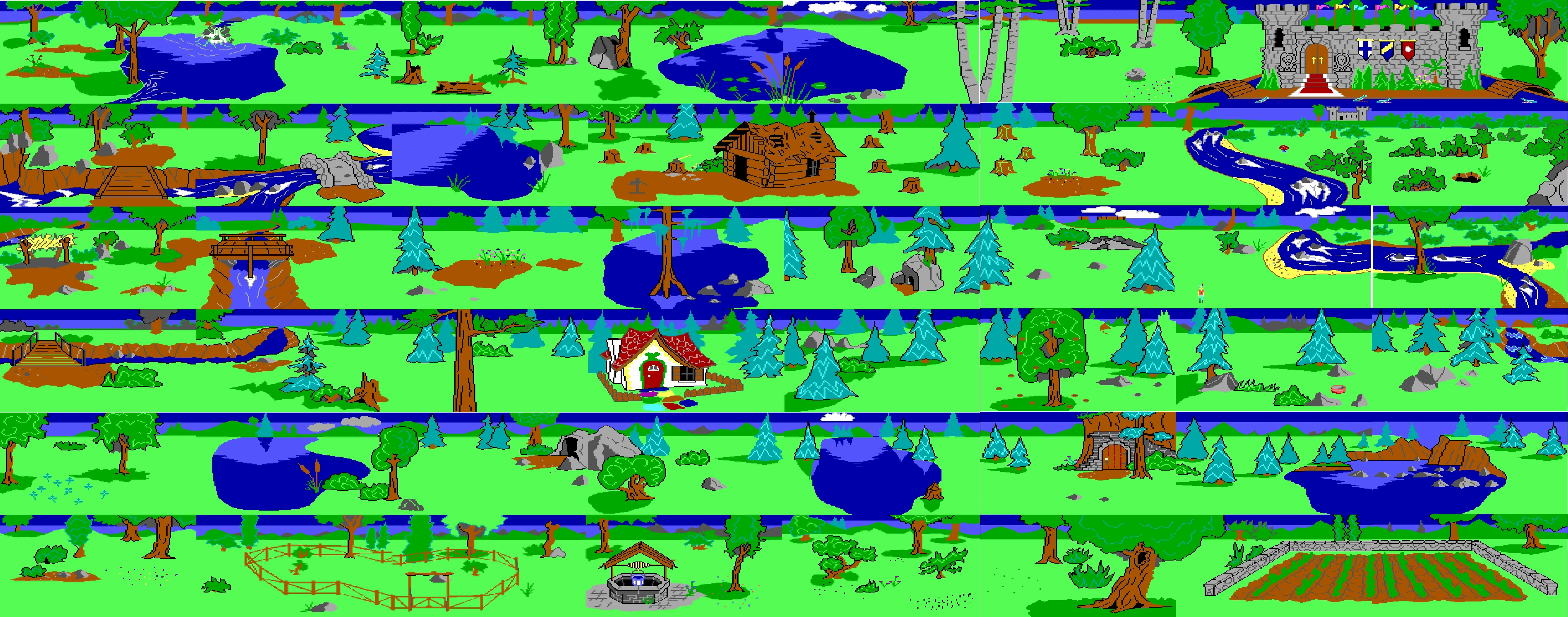
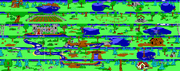
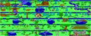
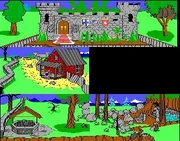
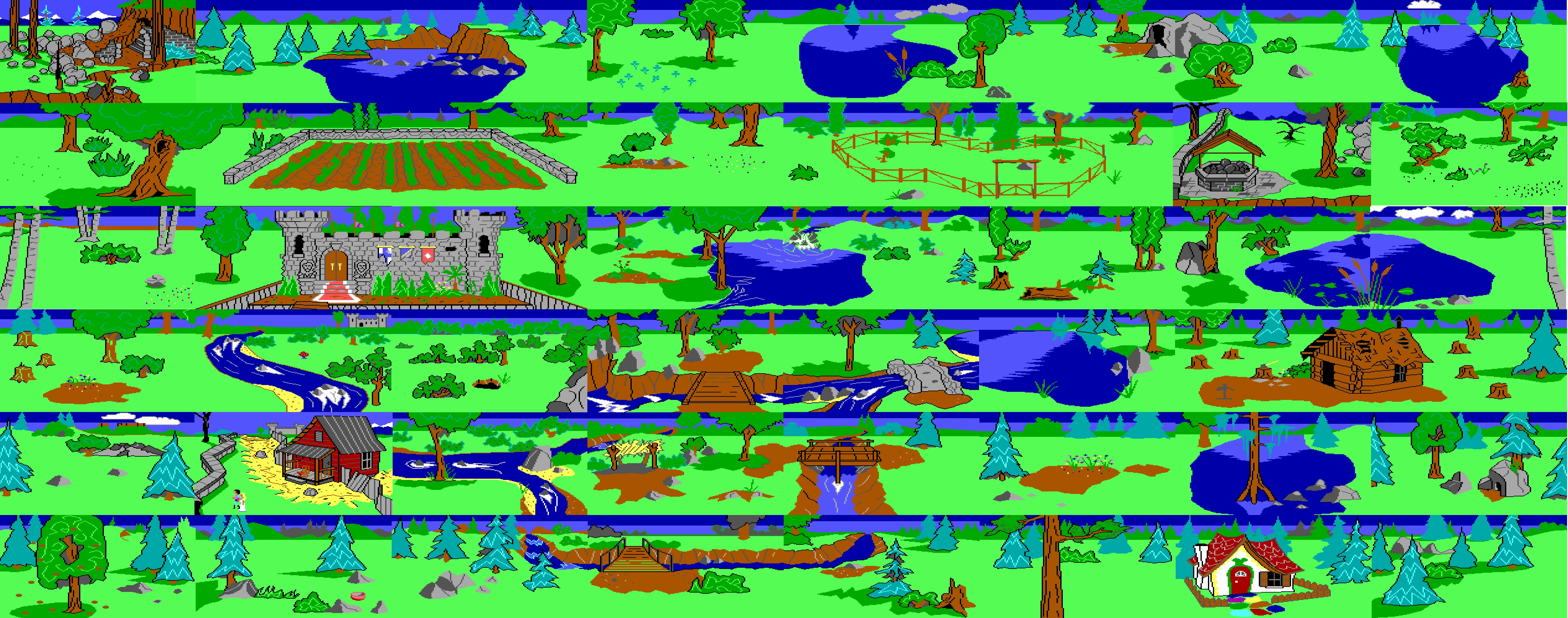
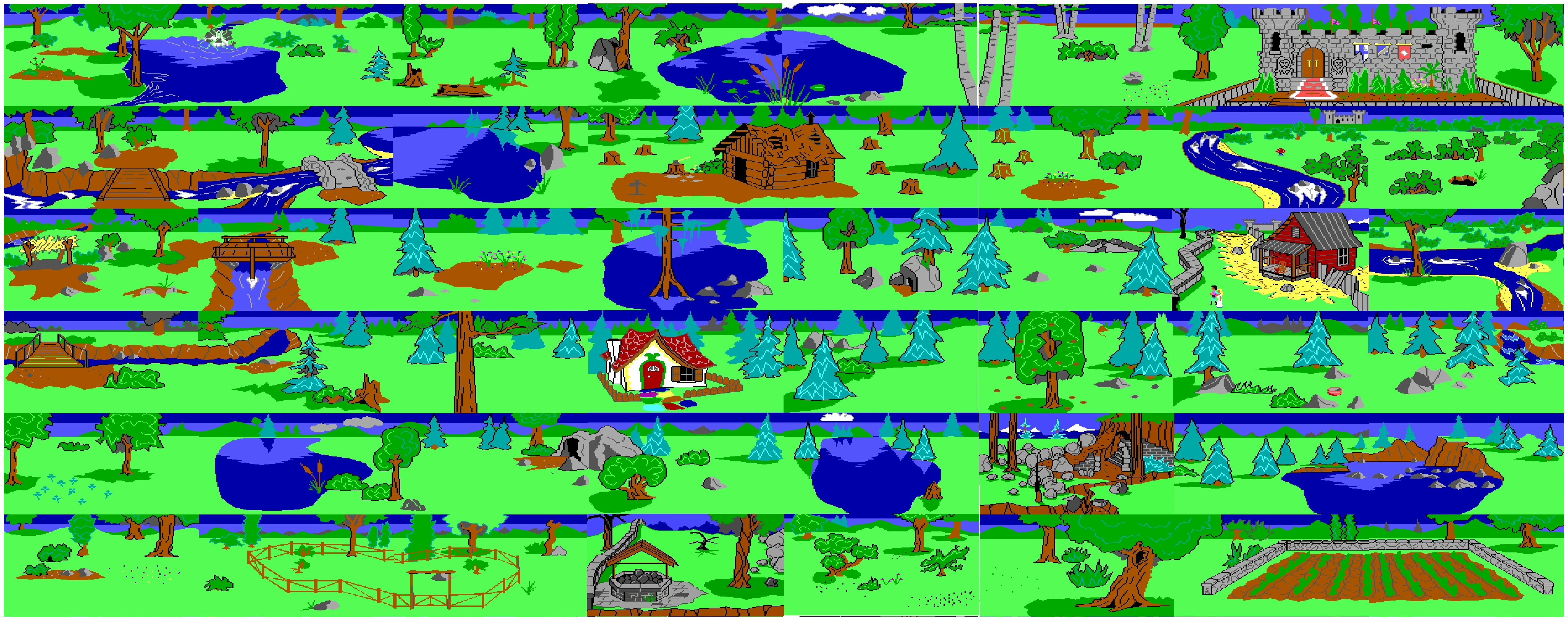
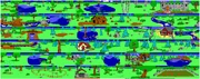
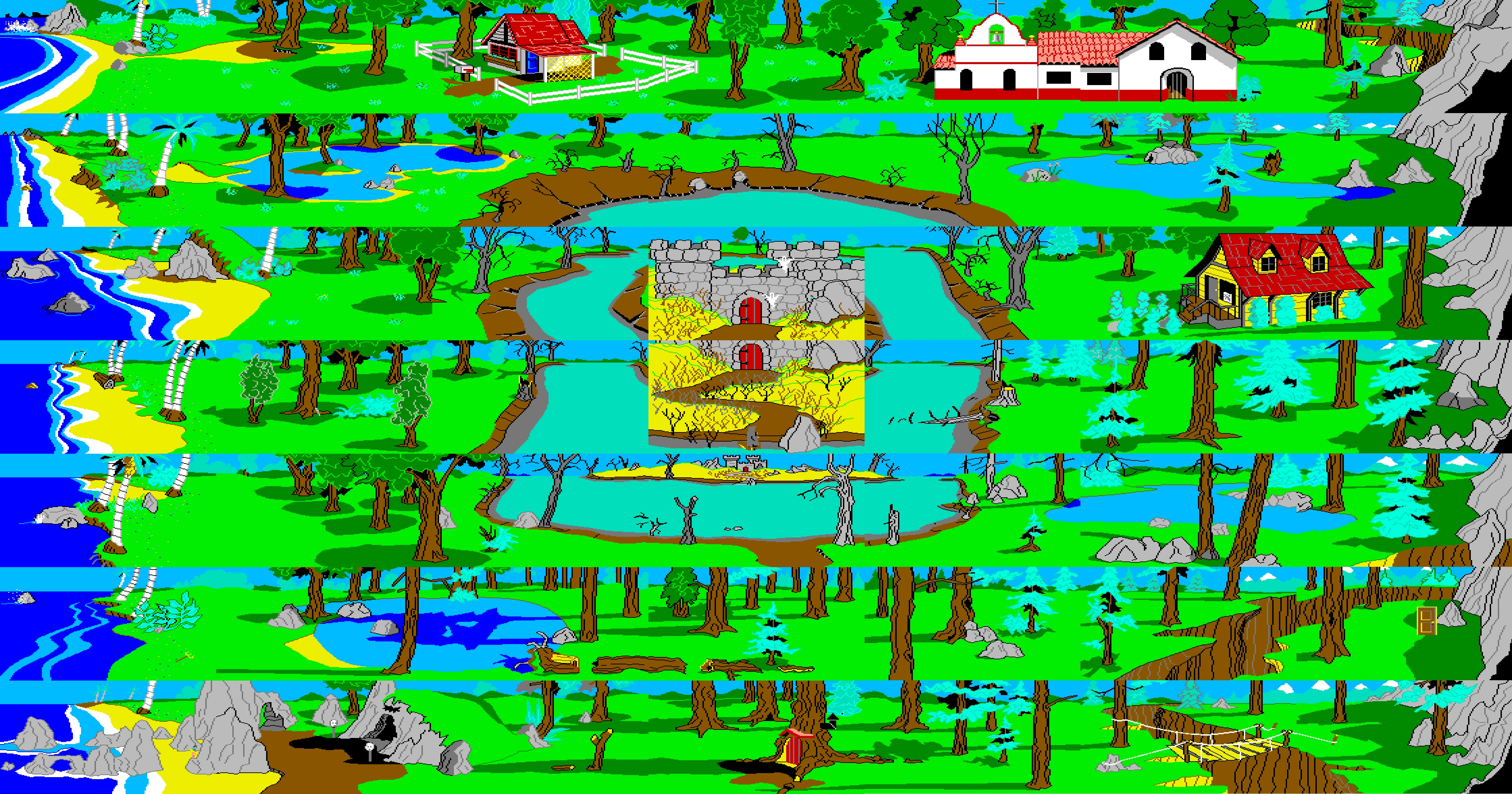
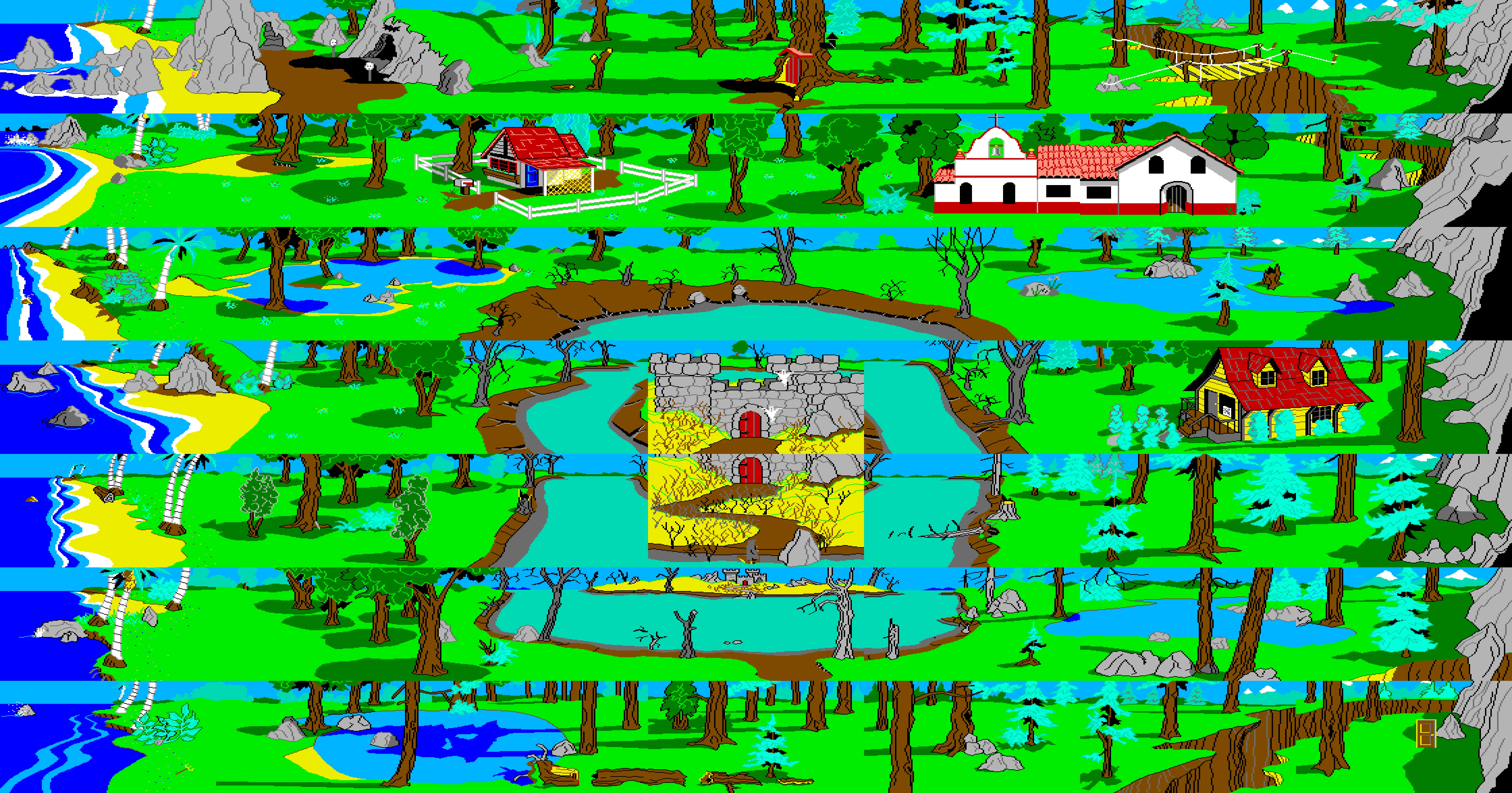
Analyzing the Map of Daventry (KQ1AGI)[]
Map Layout as it appears in official Hint Book
Defining Daventry into West Daventry and East Daventry, Castle Daventry is located in the northeast with Graham's starting position being the northeast corner. Incidently going by this The Official Book of King's Quest states Graham has come to the country, as if he had some from the east from another kingdom that is became shut-and blocked off from as soon as he entered, due to the wrap around effects. The castle is located in that corner in most of the various hintbook block maps.
The Companion adds: As you wander through Daventry, you will notice that if you go straight and far enough in any direction, you'll end up back where you started, provided there is no roadblock like a mountain, chasm, or stream that can't be crossed. When this happens, the game world and map are said to "wrap around." This is very useful for shortcuts-like walking south to get north and things like that-and is something Graham, I'm sure, would have found extremely useful.
In KQ1HB, "four-leaf clover area lies north of the fairy godmother.
KQ1AGI map showing extent of rivers around Gnome Island, and castle beyond.
Another interesting detail is the white birch trees area in KQ1 just south of the Large Oak Tree, and west of Castle Daventry, continues into the area with the 'serene mountain lake' in KQ1 AGI. One such tree can be seen one screen west. The Large Oak Tree's branches actually hang over into the western carrot patch north of the castle. Additionally south of the birch trees is an area with stumps, these wrap with the stumps near the back of the woodcutter's cottage. These three features show that wrapping occurs physically within the graphics near the western edge of the castle.
Incidentally many of the maps in the official hintbooks (including the Companion) places Castle Daventry to the north eastern corner of the map (East Daventry (Northeast Daventry)), with the rivers (or half the river area) placed more to the south (split over the east and west wrap around). The Land of the Leprechauns is often left off the maps except the western shore where the mushroom is (and given its own map).
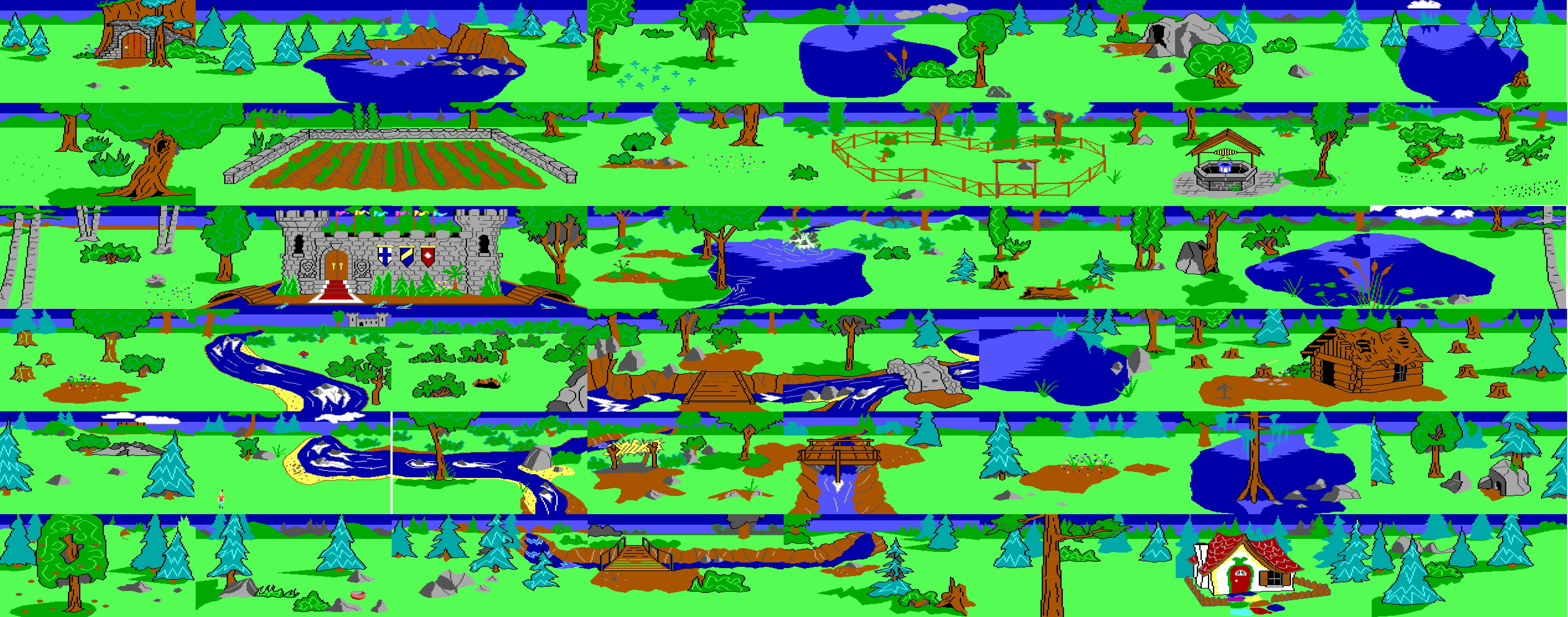
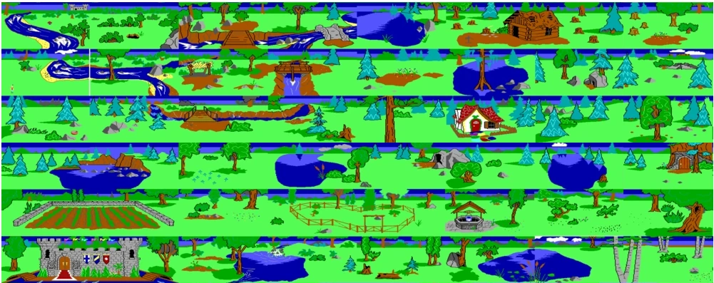
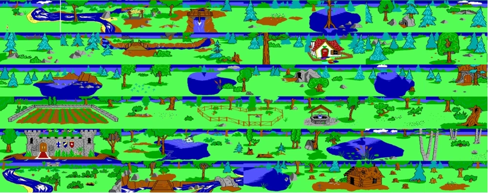
Layout based on the King's Quest Companion 1st and 2nd edition drawn maps.
Layout somewhat aligned with the KQC2nd Edition drawn map.
Layout based on the King Quest Companion 3rd edition drawn map.
Drawn maps from the King's Quest companion on the other hand are mixed some placing the castle in the southwest (and southwest edge on the continent) others in the southeast (and/or southeast edge of the continent) of the maps, see Kingdom of Daventry. These artistic maps from the Companion tend to utilize 'wrap around' and place the landmarks at different locations in each map, in relation to where the artist chose to split the map based on wrap around. For example in 1st edition Castle Daventry is in southwest side of the map, Castle Daventry in 2nd edition (which even has indication of wrap around as arrow points to Land of Leprichauns on south edge which island appears on the north side of the map) and finally in 3rd/4th edition, Castle Daventry is in the south east side of the map. Certain issues do exist however, making the maps seem like they are possibly a perspective looking at things from a slight diagonal angle. For example, in 2nd Edition drawn map, the river south of the castle is seen, but the Woodcutter's cottage appears to the north, instead of 'directly' east. Or in 3rd edition map the ANcient Well looks like its North East of the Goat Pen, with the Witch's House north east of the Ancient Well (rather than directly south), and the cave (exit to the Dragon's Lair) is northwest of the Door into the Mountain (yet south of the Ancient Well, rather than north of it).
The only areas that have a barrier that preventing travel between two screens on at least one side include the island leading to the Land of the Leprechauns. There is an invisible barrier to the north, and the east side is edged by rocks and bushes. Similarly the western edge of northern troll bridge screen which lies more or less adjacent to the 'islands eastern edge is blocked by a cliff, a tree, and a bush.
Incidentally if utilizing the Hintbook map layouts, in the novelization Graham utilizes wrap around 'twice' once near beginning to reach the carrot patch beyond the castle (located in southern edge of the map), and also on his return trip back to the castle. The companion also describes the Laye Maylie and the Carrot Patch as lieing to the 'north' of Castle daventry, explaining why they are located there in most of the drawn maps.
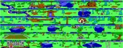
Analyzing the map of Daventry (KQ1SMS)[]
Daventry is similar to KQ1AGI, the wrapping is almost exactly the same.
The world "wraps around" (the world is round, after all). If you keep walking up, you will eventually get back to where you started.
There are a few exceptions and differences though. The 'corral' takes up one screen rather than two. There are a couple of screens where travel is only permitted in a single direction. Heading south will take the player to the next screen, while trying to head north will be be blocked by an invisible barrier. One example is the area one screen east of where the bowl is found, you can head south from the river to the north of the screen, but you cannot head north to the river from the forest screen. Like other versions of Daventry, there are lakes that wrap from east to west, and Castle Daventry can be seen on screen in an area 'north' of the Raging River.
In addition the edges of many screens often mirror the edge of the adjacent screen. So for a couple of the longer lakes, the image is just flipped on the adjacent screen. Similar thing occurs with patches of pines or birch trees in the forest.
Like KQ1AGI version of Daventry, Mushroom Isle has an invisible barrier preventing travel to the north. In addition the rightside is blocked by what appears to be another branch of Daventry's river system, which will lead to death.
One should be careful around the screen south of Raging River/mushroom as traveling north will cause the player to fall into the river if not entered from the correct position.
The door into mountain, is described as a 'small mountain', suggesting it is a singular mountain rather than part of the mountain range proper (as in KQ3).
In the KQ1HB Clover Patch is said to lie just north of the Fairy Godmother's valley.
Analyzing the map of Daventry (KQ1SCI)[]
KQ1 Sci map aligned to the KQ1 Hintbook map.
In the KQ1 remake, many of the same examples of wrapping from the original KQ1 still exist.
There are even more physical areas that overlap. For example the darker portions of the forest with the barren soil wraps across a dozen screens some north and south and some east and west.
The general area surrounding the Door into Mountain is described as "Daventry's mountain" or "foothills below a mountain" leading up to the mountain (including while up in the Land of the Clouds), suggesting a singular mountain in the center of Daventry.
The edge of the mountain slope leading up to the cliff with the door (the "foothills) can be seen sloping down to screen with Lake Maylie (in the remake).
There are additional evidence of wrapping made on screen via narrative descriptions.
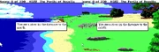
The screen south of the old well, states, "In the woods to the north, you can see what looks like an old stone well".
The descriptions of the screen one screen south of the Dragon's Lair cave states; "You vaguely see the outline of a cave entrance".
On the Mushroom Isle, the northern edge of the island is bounded by a steep cliff (the only area in which the world wrap does not occur), it is also described on the island, that in the distance, one can see "the beautiful snow-capped mountains of Daventry". Like other versions of KQ1 there are barriers preventing travel to the west in the northern troll bridge screen.
Analyzing the map of Daventry (KQ3)[]
This is the above map with the locations from KQ3 placed in the original locations in KQ1 (showing the extent of how jumbled and mismatched they are)
This is aligned to the original HB map, putting Door into Mountain, river bend, and Ancient Well south of the castle
When looking at the map of Daventry in KQ3, one might compare the map to the one that appears with those in KQ1, and notice that the landmarks shared between both do not match up in positions appeared in the previous game.
For example in KQ1 one sees that a river is almost due south from from the Castle as seen on one screen.
Whereas in KQ3, the due south is a brown dry road/path (which appears to correspond with the Dangerous River, the bend in the Raging River with the pebbles in KQ1AGI).
North and just west of the castle in KQ1 is a the Door into the Mountain (just west of Lake Maylie). A bush is shared between the two screens.
In KQ3, the door into mountain appears almost due south of the castle, and to the east (near the Great Tear). Even if going by the KQ1 HB map, Door into Mountain is south west of the castle, not south east.
Finally is the ancient well, which in KQ1 is located south west of the Door into Mountain (about three screens away and one screen south).
In KQ3, the ancient well is placed one screen due west of the Door into Mountain according to the map (about one screen north and 3-4 screens east or west from the castle), and in-game near the Great Tear, borders both.
The Great Tear a large chasm connects between the two screens and a wall connects the dried river bend and he screen with the ancient well. A path connects from the well to the castle.
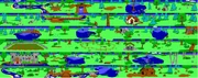
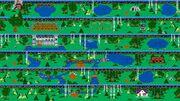
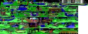
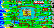
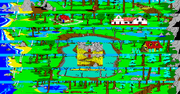
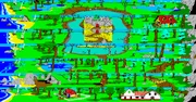
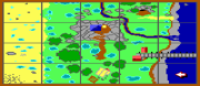
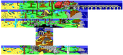
Analyzing the map of Kolyma[]
The general layout as it appears in official hint book and guides
The Official Book of King's Quest series notes that Kolyma is a rather square country; It's seven screens from east to west (left to right) and seven screens from north to south (top to bottom). In most places one can get to the north by going south since the land wraps around itself. The east-west direction is limited, however, by the ocean and mountains, so one cannot swim far enough west to meet the mountains on the east. It places the landing beach where Graham began his journey in the northwest corner of the country (as it appears on most of the hintbook game maps).
The Companion note: While adventuring through Kolyma, you will notice that if you walk far enough north and south, you end up back where you started. Kolyma "wraps around" in these directions both in the game and in reality. Mountains and chasm block the eastern edge of the country, and the ocean borders the west. There is nothing you can swim to in the western direction, and if you swim too far, you drown. When it's time to visit Neptune's home beneath the western waves, transportation will be available. After you finally walk through the magic doorway, movement is very limited, and wrapping ceases to be a consideration.
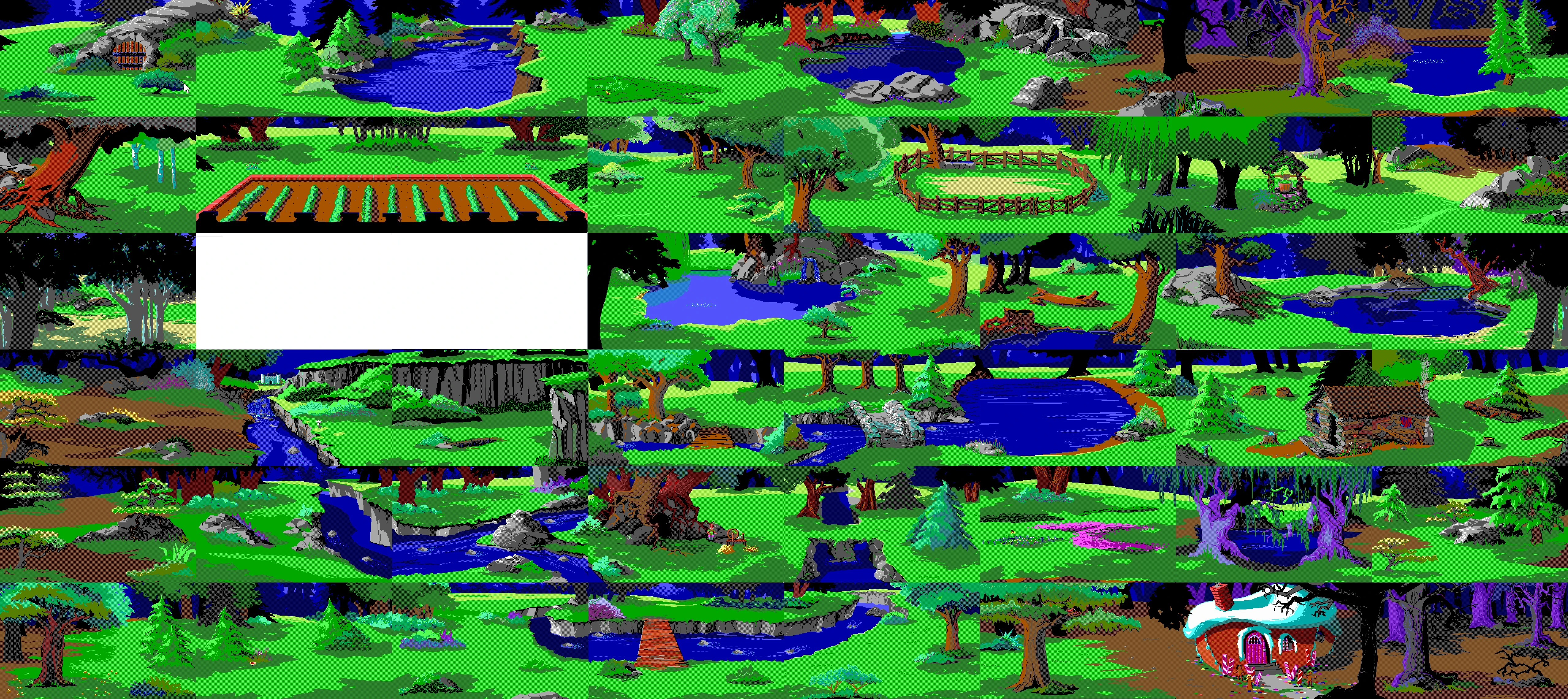
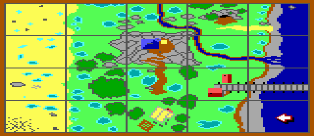
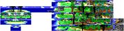
In KQ2, there are many examples of landmarks wrapping not only from east to west, but also north to south. To the right is a map made from screenshots in the game showing the progression of the beach.
Notice that many of the elements seen in the background of each screen is shown in close up with each additional screen. For example second row from bottom shows the edge of the grassy area and the start of the beach. Next screen progresses into an area near there. In the distance you can see a small hill with a grey rock next to it, and two palm trees leaning towards the east, and a small set of rocks to the west of the hill. In the next screen that same hill is seen in closeup, the two trees just behind it, and the rocks to the left of it. In the distance from that screen a scarp face can be seen, with a palm tree just to the right of it, leaning to the east (a similar structure appears in the next screen). In that screen one can see a cliff face with two rocks in the water in the distance. The next screen shows that same cliff face a bit closer, but still in the distance (it has a resemblance to Half-Dome, Sierra's logo). The next screen puts the player next to that cliff. Two palm trees can be seen in the distance, that may correspond to the two palm trees in the first grassy area (although the grassy area does not seem to show up in the distance in the previous screen). In the distance in that grassy area, one can see a single palm tree leaning to the east, next to the shore. That palm tree corresponds to a palm tree in the second grassy area, also leaning to the east, next to the shore.
One may notice that this has an immediate effect on other geographical locations and landmarks in Kolyma, for example look at the chasm, part of the chasm appears in the far north, and part of the chasm appears to the far south of the land.
In fact, no matter where you split the map (in order to define boundaries of the map), many of the landmarks will be split into half, with one half laying in the north or one half laying in the south. These major landmarks that are split no matter how you configure the map include, the beach, the poison lake, or the chasm.
See the article on Kolyma that splits the beach in half.
These details show that wrapping in the game is not only a game mechanic, but something incorporated physically into the artwork and environment of the game.
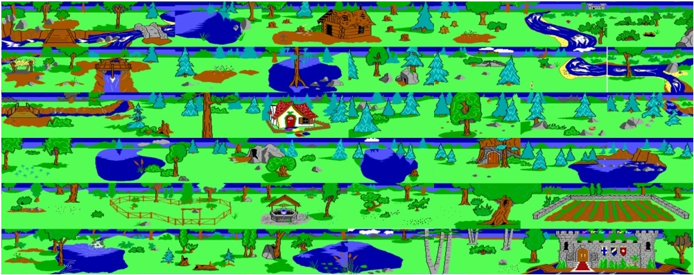
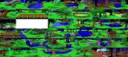
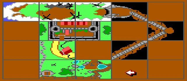
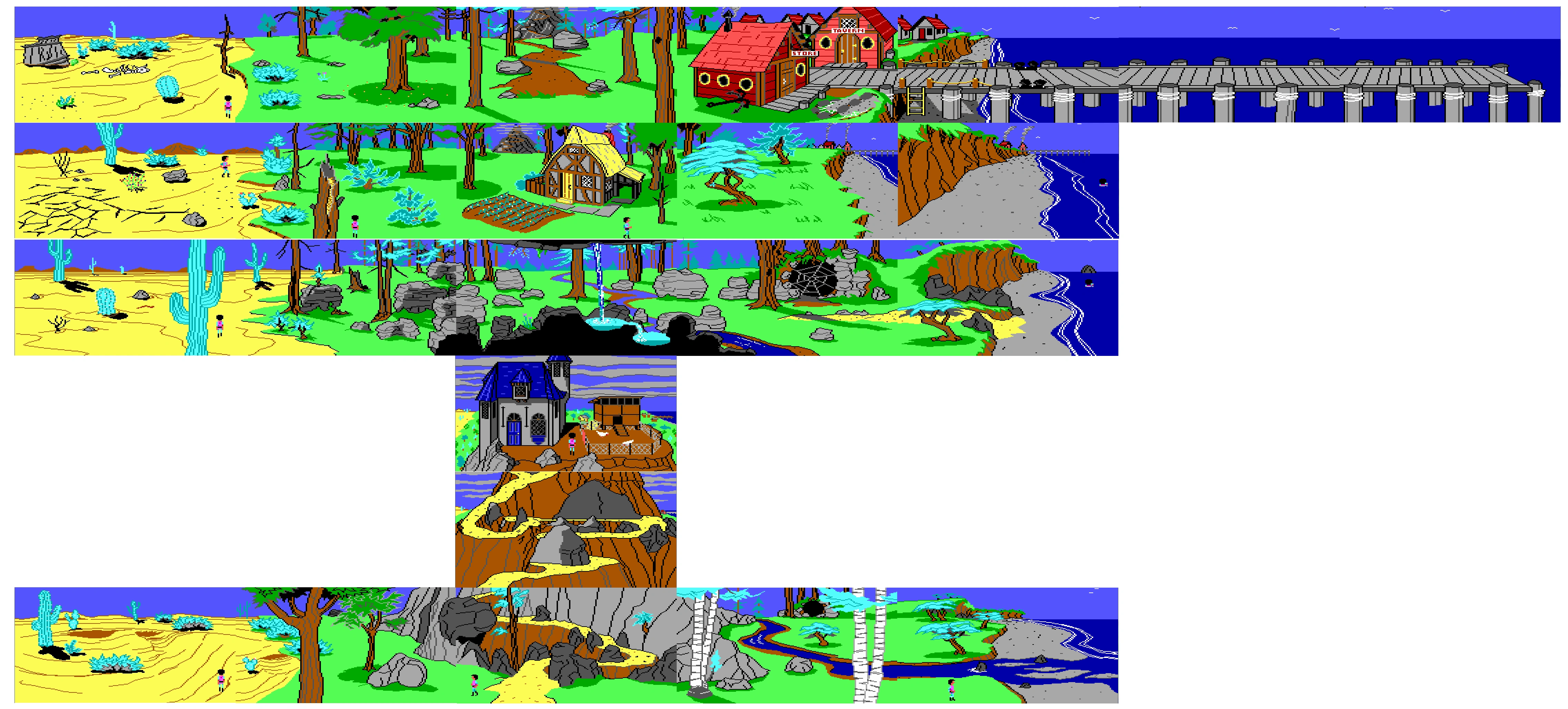
Analyzing the map of Llewdor[]
This is the layout as it appears in most maps in the Hintbooks, and the magic map.
According to the The Official Book of King's Quest series Llewdor wraps around itself in the north/south direction, but on the east and west are hideous dangers. Beyond the desert is the desert maze, and beyond the sea is the ocean maze. Once someone enters these areas even briefly, its unlikely they'll ever find their way back.[8]
The Companion notes: When you get down the mountain, you will find that Llewdor "wraps around" from north to south. If you go far enough in those directions, barring obstacles, you return to where you started.
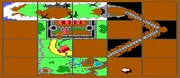
King's Quest III is slightly different than the other three early King's Quest games with wrapping, due to the fact that the map of Llewdor has a somewhat defined border created by the Magic Map. The map denotes several facts about certain landmarks in Llewdor. This includes the general location of Manannan's mountain, the direction of the river, the location of the Three Bear's House, and the location of Port Bruce, and the location of the Oracle Cave.
According to the map, Port Bruce is located southeast of Manannan's Mountain, the Three Bear's House is located directly south of the mountain, and Oracle Cave is located directly east. The river flows south from the top of the map, passes south of the Oracle Cave, before heading out to sea.
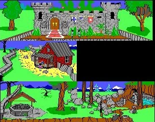
This would seem all straight forward, and seem to indicate a natural border. However, this overlooks certain facts appearing in the world itself. For example, the Three Bear's House and Port Bruce can be seen lying directly north of the mountain while looking north from the path up the mountain (Port Bruce can be seen), the top of the mountain (both Port Bruce and the Three Bear's House can be seen), and out the window of the tower in Manannan's house (the three bear's house can be seen). Directions mentioned in the house, suggests that things seen in the distance are actually aligned to the "north". For example if you look at the room in the entry hall, it states that the study is to the north of the house, and kitchen is to the east of the house, and the front door is to the south. You can also see the desert in some of the western windows of the house, and the ocean from some of the eastern windows in the house. Likewise, while outside one can see the desert to the west, and the ocean to the east. These are all indicative that everything around the house is aligned looking to the north.
In the screen that contains the Three Bear's House one can see Manannan's mountain to the north (it is also described as being "north"). One screen north is the start of the path leading up the mountain. One screen north of that is the foot of the mountain. This shows a progression in the artwork, with the mountain getting closer and closer.
Another detail to look at is the two columns with the bluff/cliff and beach. If one follows up from the area where the stream enters the bay, one notices in the distance the high cliffs of the bluff to the north. The next screens lie just below the cliff, or on the cliff respectively. In the distance once can see Port Bruce and the pier to the north. Going north one ends up at Port Bruce and/or the pier. In the distance from the pier, it seems that the cliffs elevation lowers, fading back towards the height of the stream bed. This would place the three bear's house and town north of the mountain, and seemingly fit the view seen from the top of the mountain.
These are all evidence of actual wrapping occurring not only by gameplay but also the artwork (and descriptions) themselves.
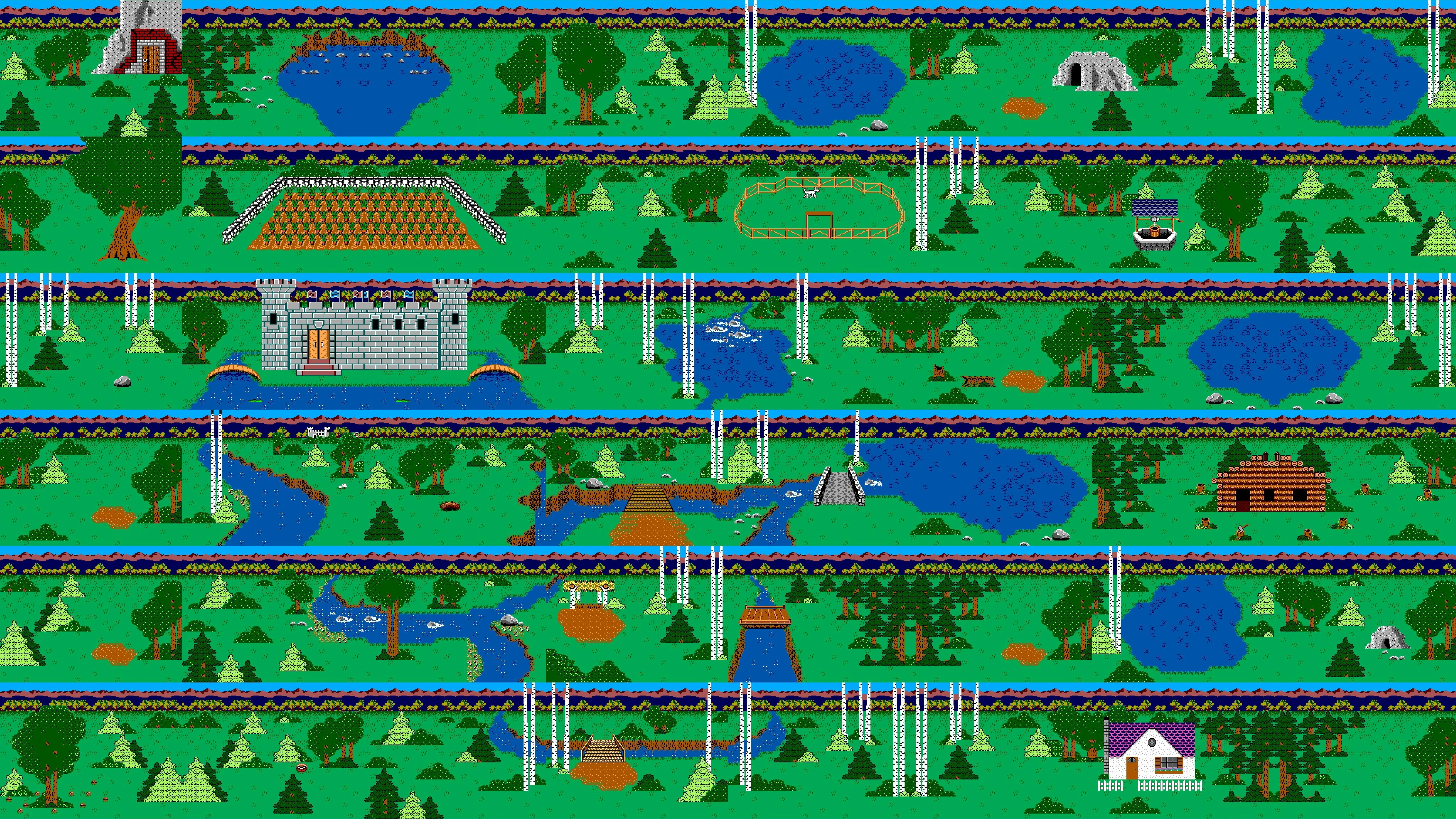
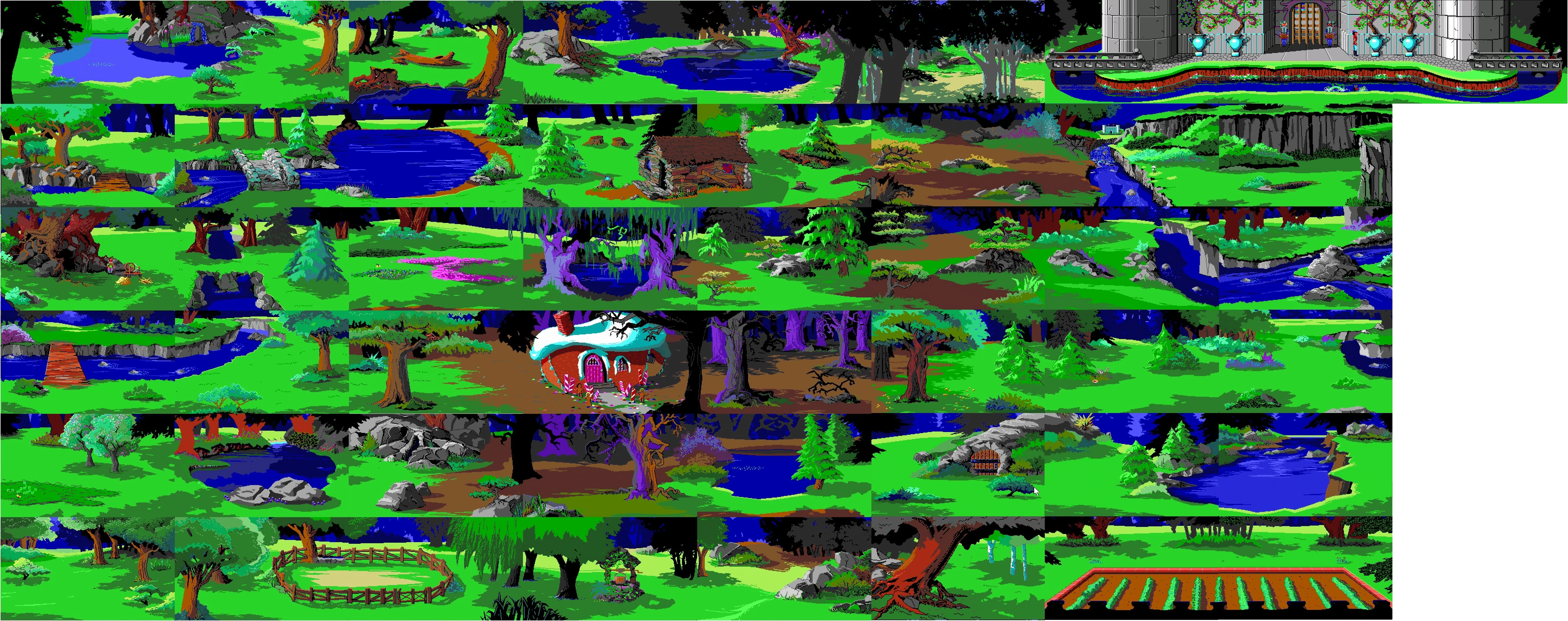
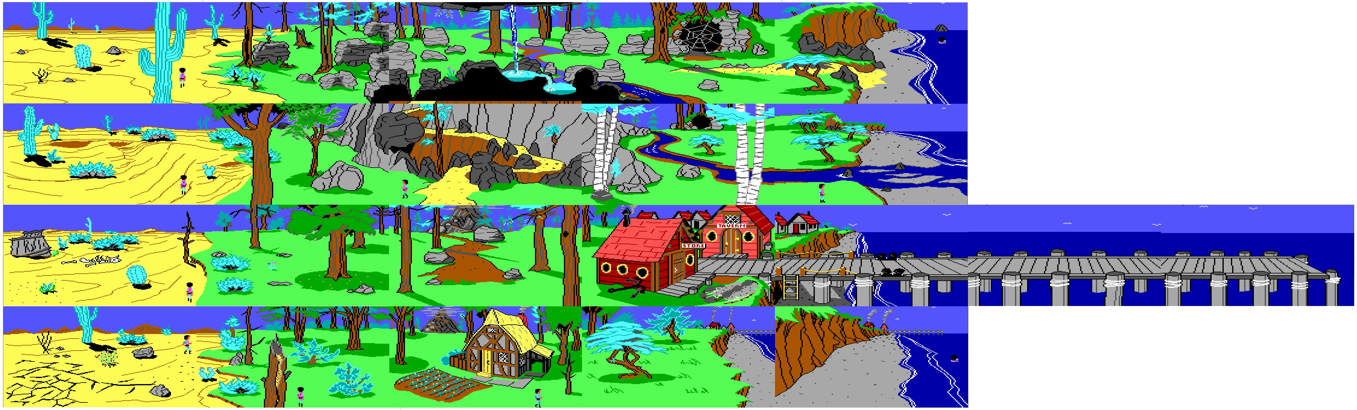
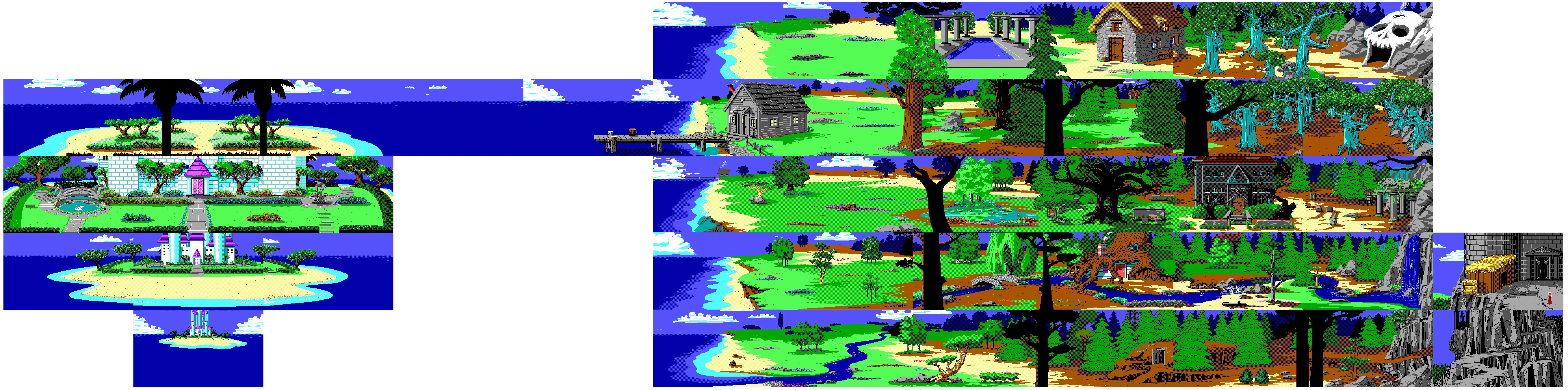
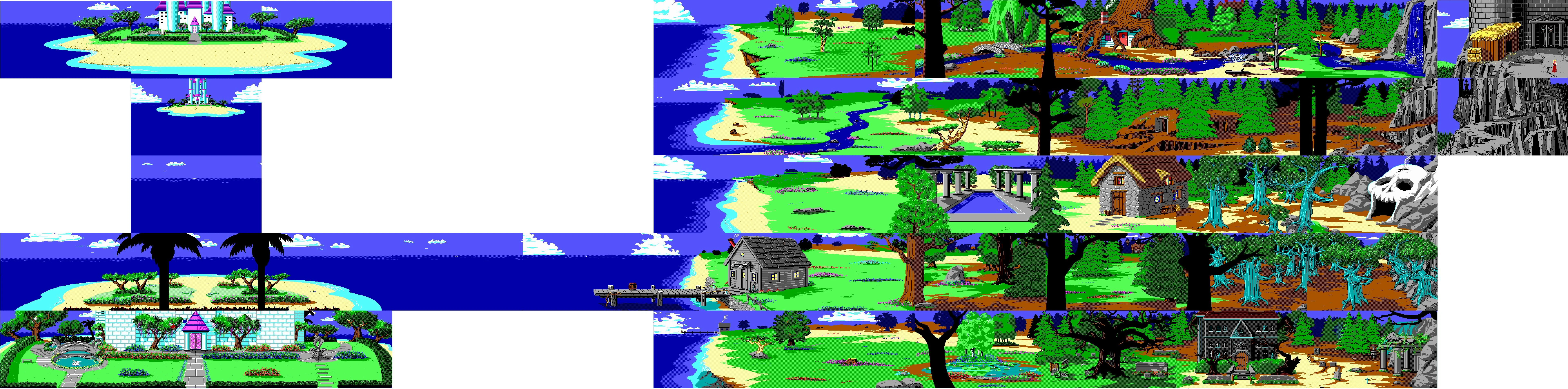
Analyzing the map of Tamir[]
This is the general layout as it appears in most hint books, and official drawn map artwork
The river can be seen to the north from the screens to the south of the river
According to the The Official Book of King's Quest Tamir is a fair-sized country. On the east are high mountains, but their is a path leading into them. On the west coast is a broad ocean with a small island two screens offshore. There is no way to swim far enough west to reach the east, but walking north does wrap around to the south.
The Companion adds... Except along the mountains, the land of Tamir "wraps around from north to south. 1f you walk south from the unicorn meadow, for instance, you eventually come back to it from the north. Mountains form the eastern border, and the ocean is on the west. Genesta's island is in the ocean, and it can only be reached by swimming.
When looking at the map for Tamir a few things stand out, one is the rocky border near on the southern edge of the screen with the path up into the Impossible Mountains. The second is the rocky border on the northern edge of the Skull Cave screen. The screenshots to the right are aligned between that edge.
The next important parts to look at that stand out are the elements that can be seen in more than two screens (with one showing landmark in the distance). These include the Fisherman's House/Pier, the Roman Pool, the Ogre's House, Whateley Manor, and finally Genesta's Fairy Island. Finally the multipart river from the waterfall that travels along two rows from east to west. These are areas that wrap northwards in the columns on the images. These examples alone do not signify the northward wrapping however, as most of these features fit between the solid borders made by the Skull Cave and mountain path screens. The exception being the river along the beach which apears on both 'north and south' edge of the map due to the way things wrap.
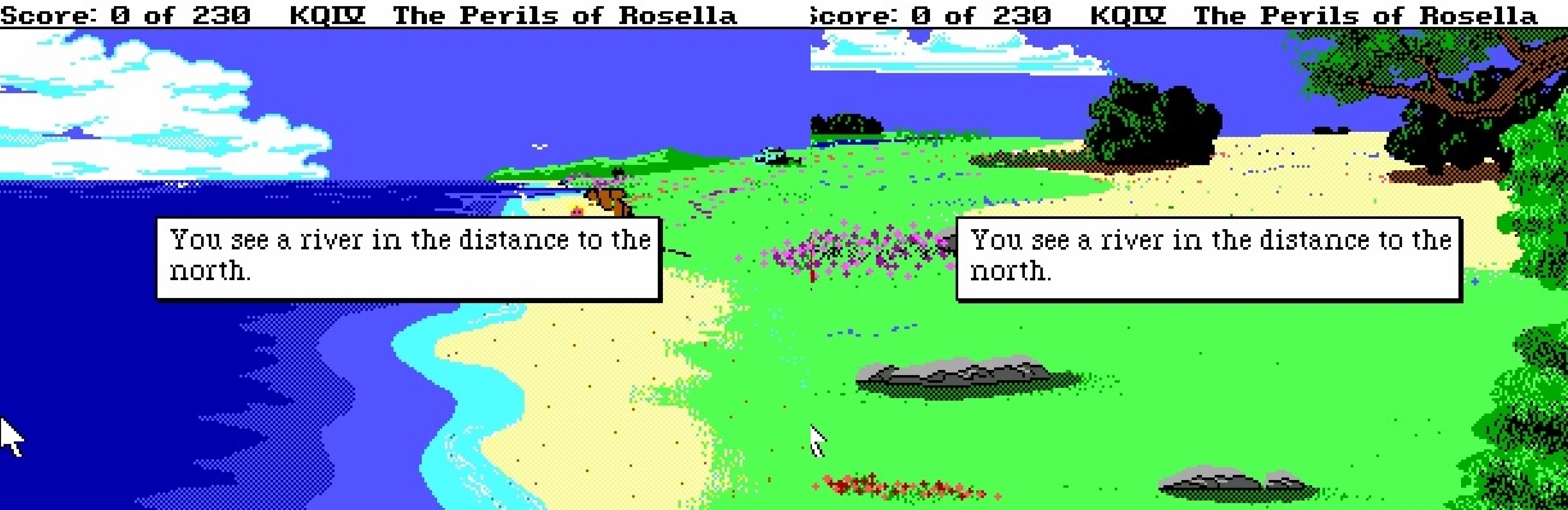
The most relevant piece of evidence that shows wrapping does occur on the map is by looking at the beach itself. The easiest way to notice this is to start with the screen with the boulder on the southern edge, the tree growing out of the rock (a place where the minstrel can randomly sit), and shows Fisherman's House and pier to the north. The boulder on the southern edge doesn't quite correspond with the screen to the south of it. In the distance one can see that the house is directly north. If you type 'look' the game even points out that that house is to the north.
Heading north you reach the Fisherman's House. Looking in the distance you can see just the signs of a small scarp face to the north. Heading north, one can get close to the scarp face. Its location is just south of a river. Note the river, as it is an important reference point in the scene (which corresponds to the scene one screen north), and is even mentioned if you look at the river[9]. Going into the next screen, the river itself, if one looks in the distance, you can see a bluff/cliff face. If you type 'look' in the screen, the description even points out the bluff in the distance. One will note that that the adjacent screens the start of the 'meadow' to the right of the beaches (with rivers) also contain sections of the river (with one screen showing the river in the distance), if you type 'look' it states that the river lies to the north.
Heading north you reach the bluff screen (which is actually the starting location in the game). This screen doesn't fit with the screen north of it, as no major features can be seen (not even the boulder that appears on the southern edge of the next screen). This would suggest that it could be the northern most element in the series of artwork. One should note that most areas in a row connect to each other along each screen edge, usually elements such as trees (so that half a tree will be seen on one screen, and the other half on the screen adjacent to it). Thinking this way if one follows directly west of the starting screen (bluff/cliffs) one reaches the southern edge of Genesta's Island. In this configuration it is cut clearly in two, with the southern half of the island located to the north, and the northern half to the south. Another example can be found, following east from the 'starting screen'. One will reach a section of the river, in which Whateley Manor can be seen in the distance (as mentioned previously). However, if the game maps are aligned to fit the beach in the correct order this would place the distance shot of the house in the top most row ('far north'), and the screen with the house itself on the bottommost row. This all direct evidence of actual wrapping going on physically within the game's artwork (and area descriptions).
The southern edge of the Scary Woods can be seen in the distance behind the Whateley Manor and eastern graveyard.
Or in the case of the alignment example in the first image above, the beach itself is split in half, with the top portion and bottom portions of the series of artwork being placed next to each other in the middle rows. This leaves the screen with the river in the distance on the top row, and the screen with the river itself on the bottom row. This also occurs with the adjacent meadow screens with the river (and river in the distance). Again a clear evidence of the map wrapping.
An attempt to align the bay and river correctly will split the spooky woods and the two screens with the ogre's house to the north and south. Any attempts to split anywhere else will divide the island in two (either directly, or the screen that shows the island in the distance with the island itself being split to the north and south).
The rock wall/pile of rocks to the south of of path into the mountains, or to the north of the edge of the cave which create a barrier between those screens, also appear to be the same 'pile rocks' and also a looped 'element' even if the player can't actually pass over them.
In other words there is no possible way to align the map, without some portion of the map wrapping between the top and bottom rows.
The Companion mentions that the marble pool lies in the northern part of Tamir, which is in line with its location on many of the hintbook/guide maps.
Following Rosella's trip around the map as accounted in Valanice's written down chronicle, it doesn't appear as if Rosella even took advantage of the wrap around, instead traveling largely within the confines of areas between Roman Pool and Skull to the North, and Diamond Mind and Path up the Mountain to the south. There may be only one example where she crosses the looping barrier, but its unclear.
Serenia[]
The Companion notes:
Unlike the first four King's Quest games, the game world of KQV does not "wrap around"-turn back on itself. Except for the desert in the west and the ocean in the east, there are definite north and south borders that will stop your progress in those directions. The desert and ocean are, for all rational purposes, endless in extent and if you didn't get killed (which you will if you try) you could stay lost in them until your computer itself dies.
Behind the scenes[]
Many of the King's Quest games are free roaming, and open-world games. Where most of the world is open to you, with very few 'linear' aspects. In the earliest games it was open-world in the quite literal sense, that developers thought of the games worlds as basically being round maps that could be explored in every direction, and return the player back to where they started.
According to the manual for the King's Quest IBM, this phenomena was described as such; "Daventry's world is has a three-dimensional quality about it, places "wrap around" like countries on a globe. Imagine Daventry as a country so large it bends around the world."
The Official Book of King's Quesr describes the phenomena as such for KQ1: "As in the real world, Daventry wraps around itself. If you go far enough east, you'll end up in the west."[10]
Some fans have theorized the phenomenon might be explainable by saying that the land is in fact an island, and the character only walks and makes circles across its shores. Imagine for example Tamir as an island with the swamp at its center, and Rosella walking around it.
However this explanation doesn't work for Llewdor since locations like Port Bruce and the Three Bear's house can be seen both north of Manannan's House from the mountain, but are also located south of it (the mountain can be seen to the north of the Three Bear's house). This would be physically impossible in the real world.
If it was an island it would also leave circumference of the island much to small to contain the endless desert on the inside. It should actually take Gwydion less time to cross through the desert to the shoreline on the other side than it does to walk around the circumference of the assumed "island", if it was an island. Also sometimes geographical locations can be seen in the distance that one can't actually reach, even if they are traveling in the direction of the locations.
In fact the wrapping also affects the Fairy Island off the coast of Tamir, which clearly can't be circling Tamir (which is another problem with the fan theory).
It also doesn't work for Kolyma, Llewdor and Tamir, as many of the screens describe elements seen in the distance (or edge of the screen) as being "north" or "south" of the position (and the left and right sides of the screen as being "west" and "east" in direction). In real life if someone was circling an island, they would not be continuously traveling "north" rather they would be changing directions, each time they made a bend around the island. There are fewer screens in KQ1, that describe directions, but in most cases visually east-west, north-south remains the same (in fact the official hintbooks print compasses pointing out that each side of the screen corresponds to regular compass points).
The island theory doesn't work at all for Daventry in KQ1, as areas wrap around (except for a small section around Land of the Leprechauns), which would be physically impossible even on an island. Even the original manual for KQ1 pointed this out (suggesting it was more like traveling around a globe).
In the cases of Daventry, Llewdor, Kolyma, and Tamir of the official games, no islands were actually visited as each one is located on continents with other lands.
References[]
- ↑ KQ PCjr manual pg. “Daventry's world is has a three-dimensional quality about it, places "wrap around" like countries on a globe. Imagine Daventry as a country so large it bends around the world."
- ↑ KQ SMS manual, pg. “The world "wraps around" (the world is round, after all).”
- ↑ The Official Book of King's Quest 1st Edition, pg. "As in the real world, Daventry wraps around itself. If you go far enough east, you'll end up in the west.
- ↑ As you wander through Daventry, you will notice that if you go straight and far enough in any direction, you'll end up back where you started, provided there is no roadblock like a mountain, chasm, or stream that can't be crossed. When this happens, the game world and map are said to "wrap around." This is very useful for shortcuts--like walking south to get north and things like that--and is something Graham, I'm sure would have found extremely useful." KQC3E, pg 324
- ↑ KQC3E, pg. “…cosmic doughnut…perhaps it was whimsy on the part of the multiverse--movement to both the north and south in this part of Kolyma eventually turned back upon itself.”
- ↑ "Daventry's world is has a three-dimensional quality about it, places "wrap around" like countries on a globe. Imagine Daventry as a country so large it bends around the world."King's Quest Manual, pg
- ↑ "As you wander through Daventry, you will notice that if you go straight and far enough in any direction, you'll end up back where yo started, provided there is no roadblock like a mountain, chasm, or stream that can't be crossed. When this happens, the game world and map are said to "wrap around." This is very useful for shortcuts--like walking south to get north and things like that--and is something Graham, I' sure would have found extremely useful." KQC3E, pg 324
- ↑ TOBOKQ3E, pg 92
- ↑ Narrator (KQ4): "You see a river in the distance to the north."
- ↑ TOBOKQ3E, pg 30